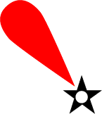
The capsized wreck of a seaplane is floating in Husavågen, presenting an obstruction near estimated position:
59° 59.5′ N, 5° 48.2′ E (WGS84)
The wreck is unmarked. All shipping should keep clear.
See also: NRK, 29 July 2022

 Husavågen: Obstruction
The capsized wreck of a seaplane is floating in Husavågen, presenting an obstruction near estimated position:
59° 59.5′ N, 5° 48.2′ E (WGS84)
The wreck is unmarked. All shipping should keep clear.
See also: NRK, 29 July 2022
 Dalsjøen: Depth
Insert sounding taken from a smaller scale source (symbol I14):
60° 00.532′ N, 5° 48.423′ E, depth 21 (21 m)
 Husavågen: Overhead cables
Insert overhead power cable with safe vertical clearance (symbol D26.2) 3 m (symbol D26.2; safe vertical clearance) connecting positions (a) and (b):
60° 00.677′ N, 5° 48.785′ E, (a)
60° 00.652′ N, 5° 48.825′ E, (b)
Delete 3 overhead cables (symbol D26) close by at position:
60° 00.68′ N, 5° 48.83′ E
 Husavågen: Overhead cable, safe vertical clearance
Amend safe vertical clearance of overhead power cable (symbol D26.2) to 3 m (symbol D26.2; safe vertical clearance) at the following position:
60° 00.66′ N, 5° 48.81′ E
 (T) Husavågen: Data collecting buoy
 Onarheimsfjorden: Hamarhaugflu light sectors
Insert sector limit 318° and amend colour of new sector 303°–318° to red.
Amend colour of sector 285°–291° to green.
Insert sector limit 4.5° and delete sector limit 7° close by.
Remark: Light character and remaining sectors unchanged; see enclosed sketch of the new sector configuration. New sector limit 4.5° intersects the southern neatline of chart 61 at 4° 59.90′ W of Oslo.
Position:
60° 00.08′ N, 4° 59.63′ W of Oslo (NGO48, chart 61)
60° 00.12′ N, 5° 43.48′ E of Greenwich (WGS84, chart 61G)
Source: Kystinfo, navigasjonsinstallasjoner fra Nautisk fagsystem / Norsk Fyrliste (145200), Kystverket, 6 December 2021

Insert  Q.R (symbols P10.6 and P11.2; continuous quick, red) in position:
60° 21.70′ N, 5° 00.24′ W of Oslo, (Sandsøya N)
Source: Norsk Fyrliste (145202), Kystverket, 6 December 2021
 Husavågen: Pontoon repaired
The damaged pontoon at the Dalsjøen general store has been repaired.
60° 00.59′ N, 5° 48.39′ E (WGS84)
Cancel Navigational Warning 2021-24.
 New Chart (NC): 63 “Husavågen”
New Chart 63 “Husavågen” is a nautical chart covering a central part of Ølve (Norway). This chart shows largely the same nautical information that official Norwegian charts show, but uses international symbology and has a larger scale.
Please note that owing to the age and quality of the source information, some detail on this chart may not be positioned accurately. Particular caution is advised when navigating in the vicinity of dangers or shoal areas, even when using an electronic positioning system such as GPS.
Scale: 1:20000
Format: ISO A4
Datum: WGS84
Small corrections: 17 May 2021
Corner coordinates:
59° 58.50′ N, 5° 46.40′ E of Greenwich (SW corner)
60° 01.10′ N, 5° 50.00′ E of Greenwich (NE corner)
This chart is free content, licensed for reuse under the terms of CC-BY 4.0.
Permalink to download the current edition: arne.johannessen.de/charts/63 (PDF)
© Arne Johannessen

Insert  between positions:
59° 59.95′ N, 5° 47.75′ E (Tråvik)
59° 59.93′ N, 5° 47.80′ E
59° 59.92′ N, 5° 48.70′ E (Grønnevika)
Move  from 59° 59.90′ N, 5° 48.20′ E to:
59° 59.80′ N, 5° 48.10′ E
Cancel NM 2021-10 (T).
Sources: Efs 09/21 (64548 *) and chart NO4F1011, Kartverket Norway, Stavanger, 12 May 2021