
Insert  in position:
60° 03.94′ N, 005° 47.27′ E, (Leitesnes N)
Source: Efs 22/14 (52448 * / Tracing), Kartverket Norway / Kystverket Vest, 17 November 2014


Insert  in position:
60° 03.94′ N, 005° 47.27′ E, (Leitesnes N)
Source: Efs 22/14 (52448 * / Tracing), Kartverket Norway / Kystverket Vest, 17 November 2014

Insert  F.R 3M (symbols P10.1, 11.2 and P14; fixed, red, range 3 M) in position:
60° 03.87′ N, 005° 55.34′ E, (Gjermundshamn NE)
Source: Efs 11/14 (51382 *), Kartverket Norway /
Kystverket Vest, 4 June 2014
Remark: Tracing available.

Insert  between positions:
59° 53.16′ N, 005° 46.30′ E (Langgota)
59° 53.55′ N, 005° 45.69′ E
59° 53.63′ N, 005° 45.05′ E
59° 53.59′ N, 005° 43.03′ E
59° 53.63′ N, 005° 42.57′ E
59° 54.16′ N, 005° 40.81′ E (Seløysundet S)
59° 54.39′ N, 005° 40.59′ E (Hestholmen W)
59° 54.56′ N, 005° 40.60′ E
59° 54.78′ N, 005° 40.27′ E
59° 54.92′ N, 005° 40.23′ E (Flatøya W)
59° 55.28′ N, 005° 40.54′ E
59° 55.75′ N, 005° 40.17′ E (Seløysundet N)
59° 55.83′ N, 005° 39.86′ E
59° 55.81′ N, 005° 39.33′ E
59° 55.69′ N, 005° 38.51′ E
59° 55.63′ N, 005° 38.43′ E (Nyborg)
Source: Efs 24/13 (49643 *), Kartverket Norway / Telenor Norge AS, 10 December 2013

Insert  in positions and delete
  close by:
60° 12.258′ N, 005° 35.864′ E
60° 12.268′ N, 005° 35.776′ E
Source: Efs 11/13 (47679 *, 47685 *), Kartverket Norway, Stavanger, 15 June 2013

Amend sector limits at Hamarhaugflu light as follows:
006.9°–012.9°, G, amend to: 006.9°–016.6°
012.9°–039.8°, W, amend to: 016.6°–039.8°
Position: 60° 00.12′ N, 005° 43.49′ E
Remark: Light character and other sectors unchanged. New sector limit 16.6° passes 185 m 460 m W of Fjæreflu beacon.
Source: Efs 04/13 (46441 *), Kartverket Norway, Stavanger, 28 February 2013 / Norsk Fyrliste (145200), Bergen, 13 May 2013
See also: Kystinfo Navigajonsinstallasjoner, Kystverket Norway
 Husavågen: Submerged rocks, iron pole
Insert  (61) (least depth 6,1 m) in position and delete sounding 16 (16 m) close by:
60° 00.78′ N, 005° 49.30′ E
Insert 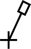 (33) (least depth 3,3 m) in position and delete sounding 19 (19 m) close by:
60° 00.49′ N, 005° 48.85′ E
Sources: Efs 11/11 (35755 *), Kartverket Norway, Stavanger, 26 May 2011; Efs 08/12 (43828 *), Kartverket Norway / Kystverket Midt-Norge, Ålesund, 16 April 2012
Remark: certain copies only. See also NM 147.

Amend sector limits at Hamarhaugflu light in position (a) as follows:
284.1°–290.9°, R
290.9°–302.7°, W
302.7°–336.4°, G
336.4°–354.4°, W
354.4°–006.9°, R
006.9°–012.9°, G
012.9°–039.8°, W
039.8°–153.2°, R
153.2°–167.6°, G
167.6°–168.8°, W
168.8°–187.9°, R
60° 00.12′ N, 005° 43.49′ E, (a)
Remark: Light character and colours unchanged.
Source: Efs 09/09 (415 *), Kartverket Norway, Stavanger, 16 April 2009
See also: Norsk Fyrliste (145200), Bergen, 19 June 2012

Insert 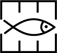 in position:
59° 58.68′ N, 005° 46.54′ E, (a)
Insert  from the marine farm in position (a) to each of the following positions:
59° 58.88′ N, 005° 46.66′ E
59° 58.77′ N, 005° 47.20′ E
59° 58.43′ N, 005° 46.90′ E
59° 58.35′ N, 005° 46.60′ E
59° 58.57′ N, 005° 45.86′ E
59° 58.78′ N, 005° 46.25′ E
Delete  in position:
59° 58.88′ N, 005° 46.67′ E
Source: Efs 08/09 (386 *), Kartverket Norway, Stavanger, 16 April 2009
Remark: Efs 08/09 includes a sketch of the situation on page 361.

Insert  Q.G 10m 4M (symbols P10.6, P11.3, P13 and P14; continuous quick, green, elevation 10 m, range 4 M) in position:
59° 58.67′ N, 005° 44.89′ E, (Store Arholmen S)
Source: Efs 03/07 (223 *), Kartverket Norway /
Kystverket Midt-Norge, Ålesund, 11 January 2007

Delete overhead cable (symbol D26) joining positions (a)–(b):
60° 00.65′ N, 005° 48.84′ E, (a)
60° 00.54′ N, 005° 48.83′ E, (b) (Storholmen N)
Source: Efs 02/06 (88 *), Kartverket Norway /
Kvinnherad Energi AS, 15 November 2005