2016-17. * Langenuen: Depths

Insert soundings in positions:
59° 53,27′ N, 005° 34,68′ E, depth 14 (14 m) (Kvitesalen)
59° 46,75′ N, 005° 31,86′ E, depth 15 (15 m) (Ytstøy)

Source: Print on Demand (POD) of chart NO 20, Kartverket Norway, 9 September 2016

Remark: Certain copies only.

2016-13. * Skånevikfjorden, Etnefjorden: Submarine pipelines

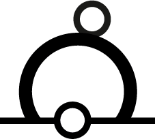
Insert submarine pipeline (symbol L41.1) between positions:
59° 43,87′ N, 005° 42,13′ E (Borgundøya)
59° 43,92′ N, 005° 42,11′ E

Insert submarine pipeline (symbol L41.1) between positions:
59° 44,58′ N, 005° 56,08′ E (Trønskeneset)
59° 44,57′ N, 005° 56,05′ E

Insert submarine pipeline (symbol L41.1) between positions:
59° 38,90′ N, 005° 55,00′ E (Vågen)
59° 38,85′ N, 005° 55,02′ E

Source: Print On Demand (POD) of chart NO 20, Kartverket Norway, 9 September 2016

Remark: Certain copies only.

2016-11. * Skånevikforden: Cables

Insert submarine cable (symbol L30.1) between positions:
59° 42,60′ N, 005° 50,70′ E (Lauvvik)
59° 42,81′ N, 005° 50,65′ E (Taraldsøya)

Delete overhead cable (symbol D26) between positions:
59° 43,2′ N, 005° 51,1′ E (Taraldsøya)
59° 43,3′ N, 005° 51,5′ E (Molnessund)

Source: Revised Reprint of chart NO 20, Kartverket Norway, 26 July 2011

Remark: Certain copies only.

2016-8. * Brucher Talsperre S: Festmachetonnen

Verschiebe Festmachetonne (Zeichen Q22 + Q40) r. (Zeichen P11.2; Farbe gelb) von Position
51° 04,59′ N, 007° 33,77′ E, DHDN90
nach Position
51° 04,651′ N, 007° 33,823′ E, DHDN90
und streiche Zeichen PA (Zeichen B7; Position angenähert).

Streiche Festmachetonne (Zeichen Q22 + Q40) r. PA (Zeichen P11.2 + B7; Farbe rot, Position angenähert) auf Position
51° 04,58′ N, 007° 33,74′ E, DHDN90

Quelle: SKGB, 25. September 2016

2015-7. * Chart 61: Geodetic datum

Insert the accompanying block, showing the differences in geographic latitude and longitude between the datums WGS84 and NGO48, centred on position:
60° 00,97′ N, 004° 57,81′ W, NGO48 (replaces note “GPS-posisjoner”)

[NM Block 1507]

Image size: 45,1 × 22,1 mm²